Cambodia Weather Forecast and Monitoring
This webpage contains specific information for Cambodian weather monitoring and forecasting with the following details:
Observed Rainfall Monitoring
(0.1-deg GSMaP Now)


- Collaboration between Japan Aerospace Exploration Agency (JAXA) and Hydro-Informatics Institute (HII) Thailand
- Global Satellite Mapping of Precipitation(GSMaP) provides global hourly accumulated rainfall with O.1*0.1 degree solution
- GSMaP shows time period of accumulated rainfall observation: every 1-hr (left) and every 24-hr (right)
- 3-hour latency from the based observation e.g., the result of 6 pm.’s information will be updated on the 9 pm. image
7-day Rainfall Forecast (Coupled WRF-ROMS Model)
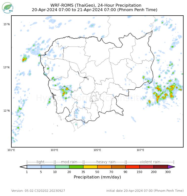

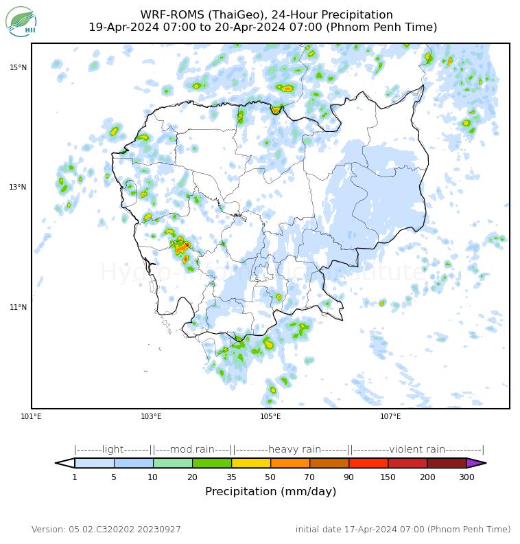
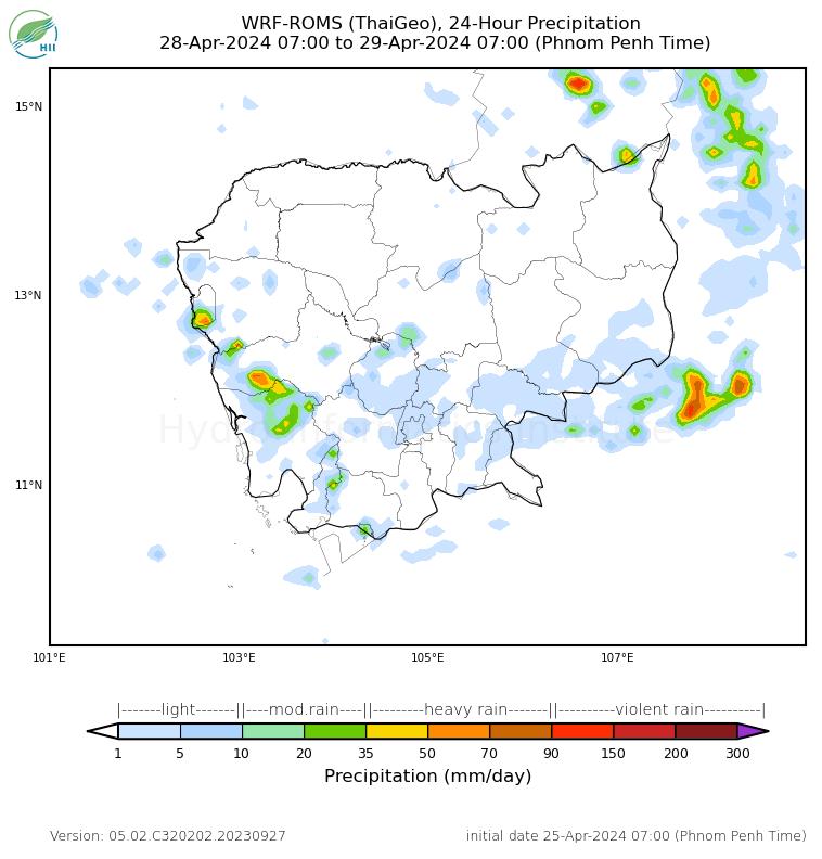
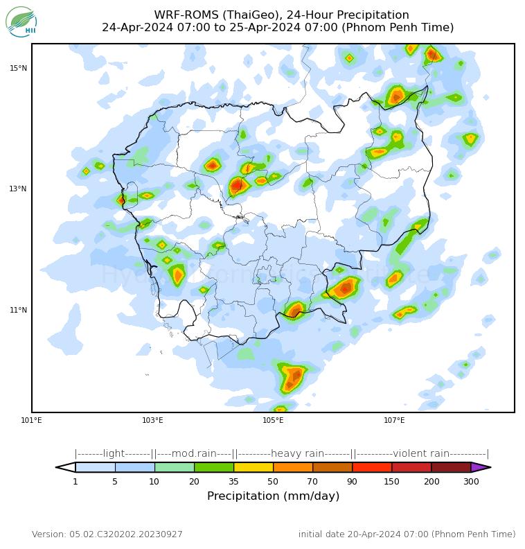


- The combination of Weather Research and Forecasting (WRF) and Regional Ocean Model System (ROMS) models to represent a more realistic of rainfall phenomena and their interaction
- WRF-ROMS forecast shows 7-day Rainfall Forecast over Cambodia
- The model forecast is issued twice aday by Hydro-Informatics Institute (Hll) for the initial condition at 00 UTC and 12 UTC.
Cambodia Weather Forecast and Monitoring
Cloud Top Temperature (HIMAWARI-9)
Weather monitoring for ASEAN
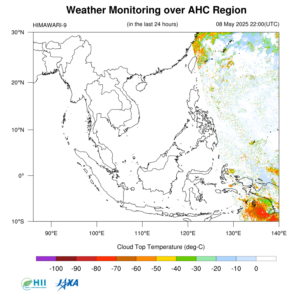
- Collaboration between Japan Aerospace Exploration Agency (JAXA) and Hydro-Informatics Institute (Hll) Thailand
- Cloud Top Temperature (CTT) is a geophysical parameter data estimated from Himawari-8* standard data
- The CTT is based on level-2 data of the Himawari’s product with 2*2 km resolution, every 10 min
- The plotted 10-min CTT map here is generated and updated by Hll every hour